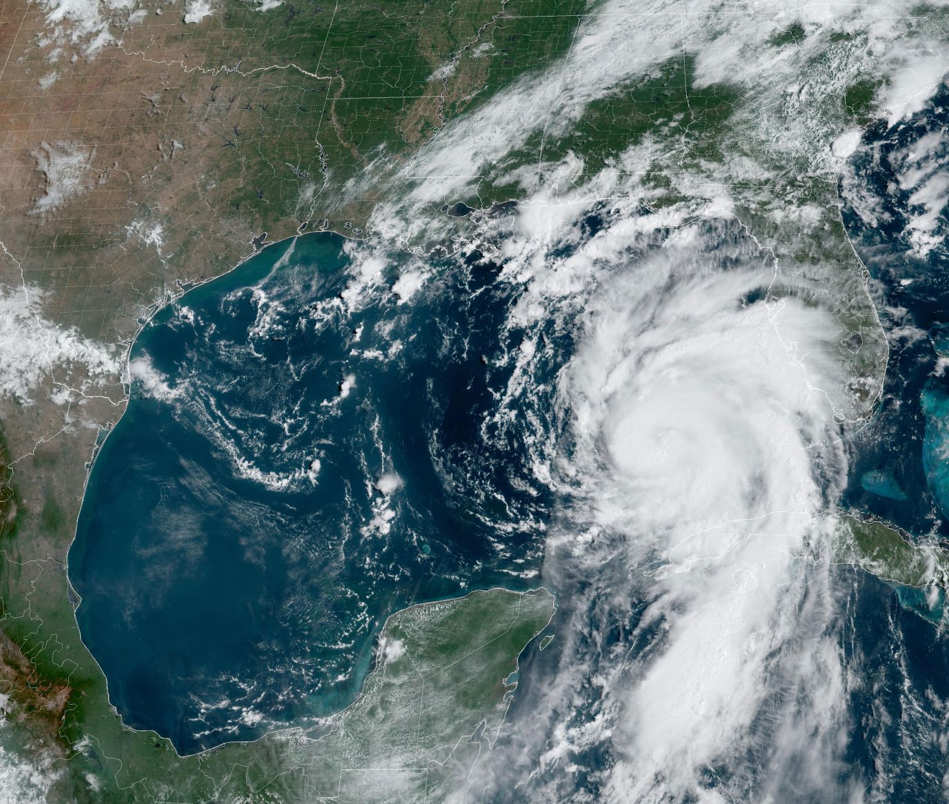
Florida residents should prepare for the arrival of Hurricane Idalia this Wednesday (30). The hurricane is expected to rapidly intensify before making landfall in the state after making landfall in Cuba with heavy rain.
On Tuesday morning (29), Idalia upgraded from a tropical storm to Category 1 hurricane status, with winds of 120 km/h. Much of Florida, including the densely populated area of Tampa, is expected to be affected by the storm.
Florida Governor Ron DeSantis has warned residents in the path of Hurricane Idalia to heed evacuation advisories without delay as it approaches the United States due to flash flooding, torrential rain, strong winds and even the formation of some tornadoes. . The storm already caused some flooding in Fort Myers Beach on Tuesday afternoon (29).
It is predicted that Idalia, even before entering the American continent, will reach intensities of 178 km/h, that is, the magnitude of a “major hurricane”. Tampa International Airport closed on Tuesday and is expected to remain closed through Thursday.
The governor of Florida has activated the National Guard. President Joe Biden approved an emergency declaration. Georgia and South Carolina declared states of emergency.
Elevated sea temperature fuels Idalia
Meteorologists are looking at several factors, but the biggest one is the very high sea surface temperature in the Gulf of Mexico. This summer, the temperature has been extremely high, with record temperatures well above average.
Near Cuba, sea surface temperatures were close to 30°C when Idalia passed the island on Monday.
As the storm moves north, it will pass over sea surface temperatures that are even higher. On Wednesday morning, the storm is forecast to reach waters that are around 31°C at the surface, which is very high.
As the ocean temperature increases, the amount of water vapor available to the storm also increases. Physics shows that warmer air can hold more water vapour. With more heat and water vapor in the atmosphere, the clouds heat up and the storm can rotate more quickly. It can also bring more intense rainfall.
The heavy rains could trigger flash flooding Tuesday through Wednesday across parts of Florida’s west coast, Panhandle and southern Georgia, spreading through Wednesday through Thursday into parts of the eastern Carolinas. This will be the first storm to hit the southeastern U.S. state this hurricane season.
In case of problems caused by Hurricane Idalia, contact ICA


Leave your comment